|
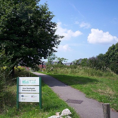
New Southgate is a residential suburb straddling three Outer London Boroughs: a small part of the east of Barnet, a south-west corner of Enfield and in loosest definitions, based on nearest railway stations, a small northern corner of Haringey in North London, England where estates merge into Bounds Green.
Its first church, founded in 1873, was among organisations opting for the newer name, New Southgate, rather than the older hamlet name Colney Hatch which from 1851 became more use-specific. The gradual demise of the former place name use is shown by New Southgate railway station, renamed five times. Changes in this terminology reflect social stigma to a large residential institution, in this case the Colney Hatch Lunatic Asylum, built in 1851, which co-provided for Middlesex and as such continued to serve much of London after London County Council was founded in 1889. The later mental health hospital closed in 1993 and has been redeveloped into two housing estates, Princess Park Manor and Friern Village in New Southgate.
The low-rise residential area with some mid-rise pockets and many small parks, recreation grounds, schools and playgrounds is characterised by housing estates with rear gardens, resulting in its relatively low population density. The district traverses three boroughs: Barnet, Enfield and Haringey. Much is a sub area of Southgate and part of an electoral ward which has usually included 'Southgate' in successive names, including Southgate Grove, and the current Southgate Green.
The first reference to New Southgate is in the 1850s. Much of New Southgate was once the hamlet of Betstile centred on a crossroads at which stood Betstile House and Betstile Lodge; Betstyle has been perpetuated since the early 20th century with Betstyle Road and Betstyle Circus.
North and east parts were known as Betstyle and as a natural progression fell into the Municipal Borough of Southgate (1881-1965); Southgate had recently grown from a broad hamlet of South Street and others in the parish of Edmonton. From 1851 Southgate constituted a district chapelry under Edmonton which replaced the semi-private Ward Chapel at Arnos Grove built in the 17th century - immediately north-east of Betstyle. The parent chapelry was upgraded with a church in 1862 and installed with stained glass windows in 1865 by D.G. Rossetti by which date it had many isolated streets of housing to serve such as around the crossroads at Betstyle (also written as Betstile).
West parts from 1409 until the 20th century were frequently referred to in title deeds as Colney Hatch. Development was tightly constrained. It was estimated the hamlet had 12 of 78 taxable houses in the narrow parish in 1795; but 33 inhabited houses in Colney Hatch are recorded in 1801. This co-parent parish extended a total of 3 miles (4.8 km) west, Friern Barnet. Maps show the name Colney Hatch, interchangeably with New Southgate, coming to cover the more developed hamlet Betstyle, in the chapelry of Southgate within the parish of Edmonton; the refined hamlet and grand asylum outweighed the initial stigma in official maps and deeds, but less so in social organisations and in the naming of the railway station, the line of which resembles the historic split between the two parishes and later districts including today's boroughs. The crossroads of Colney Hatch had Halliwick manor house standing north of some cottages on the south-west corner; The White House and The Orange Tree Inn on the north-west side near to Brook House; The Priory, north-east with Woodlands, Greenbank, and Springfield to the north to which were added the Hermitage and several cottages on the south-west corner by 1783.[5] It saw very little change in the 19th century before the construction of the county lunatic asylum: in 1882 Colney Hatch was described "as a village which had sprung up to serve the staff".
However Colney Hatch was from 1851 slowly erased from the names of schools, churches and most other organisations as residents sought to distance themselves from a lingering social stigma from passers-by and social gossip across the county of the large mental health institution. The vast site operated for many decades, first under an enforced mass segregation regime which was later abolished nationwide, to treat the mentally unwell — Colney Hatch Lunatic Asylum.
All 19th century urban development was concentrated in the east on what had been Betstyle, 1 mile (1.6 km) from the rural centre of the ancient, that is to say medieval-founded, elongated parish of Friern Barnet to the northwest. The name Colney Hatch Park was used by some developers for this area; however the new name New Southgate was increasingly adopted.
Parishes had taken over from manorial courts by devolution to their vestries chiefly in the 17th century. Southgate, extending to the north and east, became a local board in 1881, and later an urban district and municipal borough. Friern Barnet civil parish, extending in the other directions, became Friern Barnet Urban District which existed between 1883 and 1965.
St Paul's Church, New Southgate was consecrated in 1873, taking part of its parish from Christ Church, Southgate and part from St James the Great, Friern Barnet, the latter transferring land east of the Great Northern Railway. The extant ecclesiastical parish boundary likewise traverses the boroughs of Enfield and Barnet while additionally a small portion is within the London Borough of Haringey, Bounds Green Ward.
|