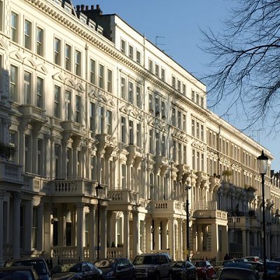
Earl's Court is a district of Kensington in the Royal Borough of Kensington and Chelsea in West London, bordering the rail tracks of the West London line and District line that separate it from the ancient borough of Fulham to the west, the sub-districts of South Kensington to the east, Chelsea to the south and Kensington to the northeast. It lent its name to the now defunct pleasure grounds opened in 1887 followed by the pre–World War II Earls Court Exhibition Centre, as one of the country's largest indoor arenas and a popular concert venue, until its closure in 2014.
In practice, the notion of Earl's Court, which is geographically confined to the SW5 postal district, tends to apply beyond its boundary to parts of the neighbouring Fulham area with its SW6 and W14 postcodes to the west, and to adjacent streets in postcodes SW7, SW10 and W8 in Kensington and Chelsea.
Earl's Court is also an electoral ward of the local authority, Kensington and Chelsea London Borough Council. Its population at the 2011 census was 9,104.
Earl's Court was once a rural area, covered in orchards, green fields and market gardens. The Saxon Thegn Edwin held the lordship of the area prior to the Norman conquest. Subsequently, the land, part of the ancient manor of Kensington, was under the lordship of the de Vere family, the Earls of Oxford, descendants of Aubrey de Vere I, who held the manor of Geoffrey de Montbray, bishop of Coutances, according to the Domesday Book 1086. By circa 1095, his tenure had been converted, and he held Kensington directly from the crown. A church had been constructed there by 1104.
For centuries, Earl's Court remained associated with the De Vere family, who likely lent their comital title to the manor house that became known as the "Earl's Court". Ownership later transferred through marriage in the early 17th century to the family of Sir William Cope. His daughter Isabella married Henry Rich, an ambitious courtier who was created 1st Earl of Holland in 1624. The manor subsequently passed to Rich and the house later constructed at Holland Park would bear his name for posterity as Holland House. Eventually, the estate was divided into two parts. The part now known as Holland Park was sold to Henry Fox in 1762. The Earl's Court portion was retained and descended to William Edwardes, 1st Baron Kensington.
The original manor house was located on the site of the present-day Earl's Court, where the Old Manor Yard is now, just by Earl's Court tube station, eastern entrance.[6] Earl's Court Farm is visible on Greenwood's map of London dated 1827.
In the late 18th century, the area began to transition from rural estates to suburban housing developments. The surgeon John Hunter had established a home and animal menagerie on the site of the former manor house in 1765. After his death in 1793, the property changed hands several times. For a period in the early 19th century it operated as a lodging house and asylum before being demolished in 1886.
At the beginning of the century, the estate was generating modest rents from farmland and some building leases.
There were unsuccessful speculative attempts at development in the 1820s, including failed housing development ventures. A two-mile conversion of the insanitary Counter's Creek into the Kensington Canal (1826 onwards) didn't attract substantial traffic and was followed by its eventual replacement by "Mr Punch's railway", which ceased operations six months after opening.[9][10][8] Building resumed slowly in the 1840s. By 1852 when Lord Kensington died, development was still confined to the northern part of the estate above Pembroke Road.
Meanwhile, the congestion apparent in London and Middlesex for burials at the start of the century was causing public concern not least on health grounds. Brompton Cemetery was duly established by Act of Parliament, laid out in 1839 and opened in 1840, originally as the West of London and Westminster Cemetery. It was consecrated by Charles James Blomfield, Bishop of London, in June 1840, and is now one of Britain's oldest and most distinguished garden cemeteries, served by the adjacent West Brompton station.
The construction of the Metropolitan District Railway in 1865-69, which eventually became London Underground's District Line and was joined after 1907 by the Piccadilly line in the 1860s, enabled the transformation of Earl's Court from farmland into a Victorian suburb. In the quarter century after 1867, Earl's Court was transformed into a loosely populated Middlesex suburb and in the 1890s a more dense parish with 1,200 houses and two churches.
Eardley Crescent and Kempsford Gardens were built between 1867 and 1873, building began in Earl's Court Square and Longridge Road in 1873, in Nevern Place in 1874, in Trebovir Road and Philbeach Gardens in 1876 and Nevern Square in 1880. Gunter estate was developed East of Earl's Court road between 1865 and 1896.
Earl's Court's only hospital was opened in 1887 on the corner of Old Brompton Road and Finborough Road. It was named Princess Beatrice Hospital in honour of Queen Victoria's youngest daughter. The hospital closed in 1978.
For most of the century, Earl's Court was home to three notable institutions, all now gone. The first and indeed oldest school of its kind is the London Academy of Music and Dramatic Art founded in 1861. It was located on the corner of Cromwell Road and Earl's Court Road, until its move to the former Royal Ballet School in Talgarth Road. The next foundation dated 1892, was the London Electronics College (formerly the London School of Telegraphy), which was located at 20 Penywern Road and in its heyday did much to expand the use of Morse code throughout the world. Already in the 1990s it was threatened with closure as technology had moved on. It finally closed in 2017 having served as a further education college offering electronic engineering and IT courses. The third institution was the Poetry Society, founded in 1909 and housed at 21 Earl's Court Square. It decamped to new premises in the recently refurbished Covent Garden district of Central London in the 1990s.
Evidently, after WWI, Earl's Court had already acquired a slightly louche reputation if George Bernard Shaw is to be believed, see his Pygmalion. Following the Second World War a number of Polish officers, part of the Polish Resettlement Corps, who had fought alongside Allied Forces, but were unable to return to their homeland under Soviet dominance (see Yalta Conference), opened small businesses and settled in the Earl's Court area leading to Earl's Court Road being dubbed the "Polish Corridor".
During the late 1960s a large transient population of Australian, New Zealand and white South African travellers began to use Earl's Court as a UK hub and over time it gained the name "Kangaroo Valley".
|