| Pepys House, 2 Cutty Sark Gardens, Greenwich - 0870 608 2000
St. Paul's Churchyard, London - 020 7332 3456
tic@visitgreenwich.org.uk
|
The district takes its name from the Kyd Brook, a watercourse which runs from Orpington to Lewisham, by which point it is part of the River Quaggy. It is a tributary to the River Ravensbourne.
The area contains a large amount of 1920s and 1930s domestic housing, developed partly as the Kidbrooke Park Estate, between Shooters Hill and Rochester Way.
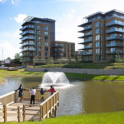
Kidbrooke was also home to the Ferrier Estate, one of the largest and most deprived council housing developments in London. The housing estate has since been demolished and redeveloped as Kidbrooke Village, a development of 4200 homes masterplanned by Lifschutz Davidson Sandilands.
Immediately south of the former Ferrier Estate is Sutcliffe park which includes a lake, acting as a flood defence, and created by partly releasing the Kyd Brook from concrete conduits underground in which it had run until 2006.
Rochester Way, a road which was built along much of the course of the old country lane Kidbrooke Lane, was intended as a bypass for Shooters Hill to the north. Rochester Way has itself now been bypassed by a dual carriageway - part of the A2 road - built in the 1980s over most of Kidbrooke Green. A small remaining piece of this open land, alongside the road, is now Kidbrooke Green Park, and adjacent to that, a small nature reserve managed by Greenwich Council. The nature reserve is visible, but not open to the public.
Some of the land encroached on by the dual carriageway, adjacent to the railway line serving Kidbrooke railway station, was formerly a Royal Air Force equipment store. Some of the buildings remain, beyond the houses of Nelson Mandela Way, but the site is now little used. The nearby Thomas Tallis School is built on the former site of an RAF aerodrome, formerly a barrage balloon centre. (There are several other military facilities in the general vicinity, which is also close to a surviving base in Woolwich, long home to the Royal Artillery and now to other parts of the British Army.)
|