|
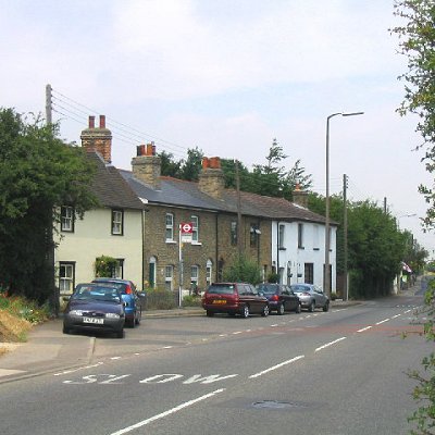
North Ockendon is the easternmost settlement of Greater London, England, and part of the London Borough of Havering. It is 18 miles (29 km) east-northeast of Central London and consists of a dispersed settlement within the Metropolitan Green Belt. It was historically an ancient parish in the county of Essex, which was abolished for civil purposes in 1936. North Ockendon is the only inhabited area in Greater London outside the M25 London Orbital Motorway. North Ockendon is north of South Ockendon, in Thurrock, Essex.
North Ockendon ancient parish had an elongated east–west shape, thus contrasting with a series of perpendicular parishes to its north and west. With the adjoining parishes this formed a large estate that is at least middle-Saxon or, perhaps, even Roman or Bronze Age. The parish church, dedicated to Mary Magdalene, was built in the fourteenth century, on the site of an earlier church.
From 1894, North Ockendon formed a parish in the Orsett Rural District of Essex. In 1931 the county council proposed that the parish should transfer to Purfleet Urban District as part of a review of districts triggered by the Local Government Act 1929. The proposals met with objections and by 1933 it was decided to divide the parish between an expanded Hornchurch Urban District and a new Thurrock Urban District. Purfleet Urban District Council took legal action in an attempt to revert to the earlier scheme, ultimately taking the case to the House of Lords without success. In 1936 the majority of its former area was used to enlarge the Cranham parish of Hornchurch Urban District. The remainder, around 383 acres, became part of Thurrock Urban District. North Ockendon was still rural at the time of its inclusion in the Hornchurch Urban District, but it was anticipated suburban house building would soon encroach on the parish. The creation of the Metropolitan Green Belt meant the limit of London's urban sprawl stopped just short of the parish boundary, and North Ockendon remained rural.
In 1965, Hornchurch Urban District was abolished, and its former area, including North Ockendon, was transferred to Greater London and used to form the present-day London Borough of Havering. North Ockendon and Great Warley were to the east of the M25 motorway when it was constructed. In 1992, it was proposed that the part of Greater London to the east of the M25 should be transferred to Essex, with the Great Warley section north of the railway transferred to Brentwood and the North Ockendon section to the south transferred to Thurrock. The transfer of North Ockendon from London to Essex was strongly opposed, with Nicholas Bonsor MP stating that his constituents agreed it had "more affinity with Havering than with Thurrock". Following the review the Great Warley section was transferred to Essex, but the North Ockendon part was not, leaving it the only part of Greater London to be outside the M25 motorway.
North Ockendon is the location of Stubbers, a former stately home which was demolished in 1955, the grounds of which are now used as an activity centre.
|