
Like us on Facebook
PLACE NAMES


|
|
Harold Hill
|
| |
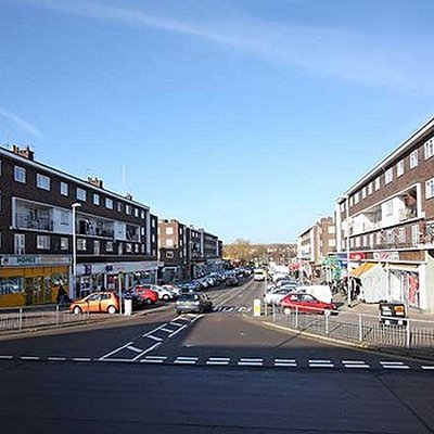
Harold Hill is a suburban area in the London Borough of Havering, East London. 16.6 miles (26.7 km) northeast of Charing Cross. It is a district centre in the London Plan. The name refers to King Harold II, who held the manor of Havering-atte-Bower, and who was killed at the Battle of Hastings in 1066. The suburb is peripheral to London, forming an eastern edge of the urban sprawl.
The extensive London County Council housing development of Harold Hill was conceived in the Greater London Plan of 1944 in order to alleviate housing shortages in Inner London. Before construction of the estate, which was completed in 1958, it was the location of Dagnam Park house and grounds, and in the Municipal Borough of Romford and the county of Essex, but was transferred to Greater London in 1965. The first Greater London Council tenant to buy their council house did so here in 1967. The area is part of a long-term regeneration project led by Havering London Borough Council.
The area that became Harold Hill formed part of the Harold Wood and Noak Hill wards of the parish of Hornchurch; the large ancient parish occupied the same area as the royal manor and liberty of Havering. The boundary between Harold Wood and Noak Hill was formed by a tributary of the River Ingrebourne. In the Harold Hill area the manor was subdivided into Dagnams, Cockerells and Gooshays. The Havering courts and Romford vestry were the principal local government in the area. The Havering liberty was abolished in 1892 and the vestry in 1894. Following the Local Government Act 1894 the area was split between the parishes of Romford Rural (in the west) and Noak Hill (in the east), each with a parish council and within the Romford Rural District. In 1900 the Romford Rural parish was abolished and the area was then split between the Romford Urban District (in the west) and Noak Hill in Romford Rural District (in the east). In 1934 Romford Urban District absorbed Noak Hill, bringing the whole area under the authority of Romford Urban District Council. Romford was incorporated as a municipal borough in 1937 governed by Romford Borough Council, which was the local authority during the construction of the estate. The Municipal Borough of Romford was abolished in 1965 and Harold Hill became part of the London Borough of Havering in Greater London.
|
 Feel free to Email me any additions or corrections Feel free to Email me any additions or corrections
LINKS AVAILABLE TO YOUR SITE
| |


