
Like us on Facebook
PLACE NAMES


|
|
Tooting
|
|
|
|
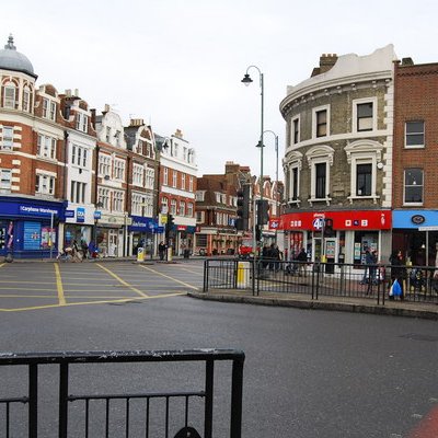
Tooting is a district in South West London, forming part of the London Borough of Wandsworth and partly in the London Borough of Merton. It is located 5 miles (8 kilometres) south south-west of Charing Cross.
Tooting has been settled since pre-Saxon times. The name is of Anglo-Saxon origin but the meaning is disputed. It could mean the people of Tota, in which context Tota may have been a local Anglo-Saxon chieftain. Alternatively it could be derived from an old meaning of the verb to tout, to look out. There may have been a watchtower here on the road to London and hence the people of the look-out post.
The Romans built a road, which was later named Stane Street by the English, from London (Londinium) to Chichester (Noviomagus Regnorum), and which passed through Tooting. Tooting High Street is built on this road. In Saxon times, Tooting and Streatham (then Toting-cum-Stretham) was given to the Abbey of Chertsey. Later, Suene (Sweyn), believed to be a Viking, may have been given all or part of the land. In 933, King Athelstan is thought to have confirmed lands including Totinge (Tooting) to Chertsey Abbey.
Tooting appears in the Domesday Book of 1086 as Totinges: Lower Tooting was held from Chertsey Abbey by Haimo the Sheriff (of Kent) when its assets were 1 church, 2½ ploughlands of land and 5 acres (2 hectares) of meadow. Its people were called to render £4 per year to their overlords. Later in the Norman period, it came into the possession of the De Gravenel family, after whom it was named Tooting Graveney. Until minor changes in the 19th century it consisted of 2 km (¾ sq mi). The ancient parish of Tooting Graveney included the southern part of what is now Streatham.
Upper Tooting, or Tooting Bec (for centuries administered as part of Streatham), appears as a manor held by the Abbey of Hellouin Bec, in Normandy, thus acquiring the "Bec" in its name. Its domesday assets were 5 hides. It had 5½ ploughlands and so was assessed as rendering £7.
As with many of South London's suburbs, Tooting developed during the late Victorian period. Some development occurred in the Edwardian era but another large spurt in growth happened during the 1920s and 30s.
|
 Feel free to Email me any additions or corrections Feel free to Email me any additions or corrections
LINKS AVAILABLE TO YOUR SITE
| |


