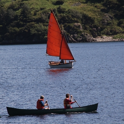
Ullswater is the region's largest lake, a little less than eight miles long and with two distinct bends to it. Some people consider the lake superior in beauty to Windermere, but there are distinct differences. Unlike Windermere, Ullswater has its head in the steep Borrowdale volcanic rocks, and its feeders pout off Helvellyn to the south west, and off a tangle of rough fells to the south east. You will notice from the centre that the landcape changes rapidly, as the lake penetrates the more friable Skiddaw Slates, and at the foor there are flatter plains of limestone and sandstone stretching towards Penrith.
The Ullswater Navigation Company runs a 'steamer' service in the season. The journey south from Pooley Bridge Pier offers, without doubt, the best view of the changing scene. Behind the pier is Dunmallot on top of which is the ruin of a ditch and mound Romano-British fort. The ancient British road, High Street, high to the south-east was improved by the Romans.
The next pier south is at Howtown (no town incidentally, just a few houses and the delightful Sharrow Bay Country House Hotel). The route then goes through the narrows with 'Skelly Neb' to the north. In the old times, a net was spread across the lake here, to catch the 'Schelly', a whitefish found only in this lake. Above to the south is Hallin Fell, which can be climbed easily from the minor road on its south side. Its views are among the best anywhere. 'Gowbarrow Park' on the north side was once a deer park and it was here that Wordsworth saw his daffodils. To the west is Aira Force, a spectacular waterfall on Aira Beck, with viewing bridges in a wooded ravine. The lake then turns south, with the Helvellyn range seen to the south west and Place Fell closing in on the east. The south pier is at Glenridding. The lake holds trout and perch as well as the aforementioned 'schelly'. Powered boats are allowed on the lake but at a maximum speed of 10mph. Craft can be launched at Glenridding and also at Howtown.
One of the best walks in the Lake District is along terraced paths on the wooded east shore.
|