|
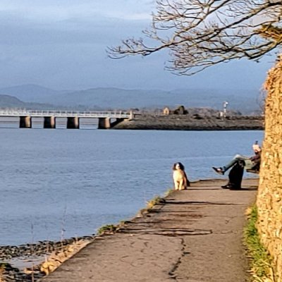
Arnside is a village and civil parish in Westmorland and Furness, Cumbria, England. It is historically part of Westmorland, near the border with Lancashire. The Lake District National Park is located a few miles north. Travelling by road, Arnside is 10 miles (16 km) to the south of Kendal, 25.3 miles (40.7 km) to the east of Ulverston, 35.2 miles (56.6 km) to the east of Barrow-in-Furness, 13 miles (21 km) to the north of Lancaster and 14.3 miles (23.0 km) to the east of Grange-over-Sands. In the 2001 census the parish had a population of 2,301,[2] increasing at the 2011 census to 2,334.
It faces the estuary of the River Kent on the north-eastern corner of Morecambe Bay, within the Arnside and Silverdale Area of Outstanding Natural Beauty and is overlooked by Arnside Knott, a hill that rises out of the estuary. A detailed account of the wildlife of the Arnside and Silverdale AONB is provided by John Wilson and Peter Lennon. Mammals include red squirrel and otter, breeding birds at the time of publication included the bittern which is still found in the area.
The village has been attractive to visitors since the 19th century but never developed as a traditional seaside resort. Writing in The Local Historian, Caunce describes it as "an unwitting pioneer of eco-tourism", with visitors attracted by the scenery and in particular Arnside Knott.
The oldest building in the parish is Arnside Tower, a Peel tower built in the 14th/15th century as a refuge against raids from Scots and the Border Reivers.
The former customs house is now occupied by the Sailing Club, and many of the buildings on the promenade were built as accommodation for visitors.
The railway line is carried over the River Kent on a viaduct 552 yards (505 m) long, it was built in 1857 and rebuilt in 1915.
|