Like us on Facebook
PLACE NAMES


 
|
|
Saint Clement
|
| |
|
Saint Clement is one of the twelve parishes of Jersey in the Channel Islands. Its parish hall is around 3.6 kilometres (2.2 mi) south-east of St Helier. It is the smallest parish by surface area, but the second most densely populated. Its surface area is around 1,044 acres.
It is on the south-east coast of the Island, and contains some of the suburbs of Saint Helier. St. Clement stretches west to east from Le Dicq to within a quarter mile of La Rocque harbour (at the end of Rue de la Lourderie).
The parish is subdivided into three vingtaines, and is administered at local level by the Connétable.
Much of the parish lies below equinoctial high-tide level and was frequently flooded before Le Dicq was built to try to hold back the sea somewhat. There are remains of a submerged forest underneath the sand at Grève d'Azette that show how the parish has reduced in size as the sea has advanced. Large floods in 1688, 1796 and 1812 led to the coast road at Le Hocq being swept away by the sea and necessitated the coast road being rebuilt further inland.
In pre-Norman times, the area now known as St. Clement was known as Petravilla or Pierreville. In 1172 it was recorded that a chapel existed in the parish, and there was a priory on the site of the old Priory Inn (now houses).
In the 16th and 17th centuries the parish was believed to be the centre of a witch movement. According to beliefs, the rock at Rocque Berg (known as the Witches' Rock) was the focus for witchcraft in Jersey and witches would assemble there for their sabbats on Friday nights.
After the revocation of the Edict of Nantes in 1685, many French Protestants settled in the parish - as recorded on the church register.
In the mid 19th century, the town began to spread east from St. Helier into the west of the parish. Today there is relatively little open green space (with the exception of the golf and football fields) west of Samarès Lane into St. Helier.
Landmarks include:
- La Motte is a tidal island and archaeological site
- The dolmen at Mont Ubé (off La Blinerie) is believed to have been left there by a pre-Celtic race called the Iberians, in around 3,000 B.C. Remains of a cemetery on La Motte (Green Island) are believed to be from later settlers. A Neolithic cairn and middens on La Motte have also been investigated.
- Samarès Manor is a manor house with medieval origins in the Vingtaine de Samarès, and is the traditional home of the Seigneur de Samarès. The name Samarès is an old French word meaning salt-marsh, and much of the low lying surrounding areas are or were coastal marshes.
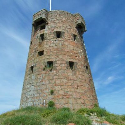
- Le Hocq Tower was built in 1778 as a coastal defence against the French when they sided with the American colonies against the British.
- Seymour Tower sits two miles offshore on one of the largest inter-tidal reefs in the world. Built as part of Jersey's coastal defences, this square tower dates from the 18th century.
|
 Feel free to Email me any additions or corrections
LINKS AVAILABLE TO YOUR SITE
| |
