Like us on Facebook
PLACE NAMES


 
|
|
Saint Brelade
|
| |
|
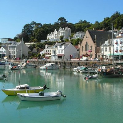
Saint Brelade (French: Saint Brélade) is one of the twelve parishes of Jersey in the Channel Islands. It is around 7 kilometres (4.3 mi)[a] west of St Helier. Its population was 10,568 as of 2011.
The parish is the second-largest parish by surface area, covering 7,103 vergées (3,157 acres), which is 11% of the total land surface of the island and it occupies the southwestern part of the island. It is the only parish to border only one other parish, St. Peter.
The parish is largely a suburban commuter area for St Helier, with expansive low rise residential development, especially in the area of Les Quennevais. However, the parish also has a number of notable natural sites, such as the sand dunes of St Ouen's Bay.
Jersey's prison is situated at La Moye, and the island's desalination plant is also sited in the parish.
St Aubin's Fort is located on an islet in St Aubin's Bay. It was built at the command of Sir Henry Cornish in 1542. It became a fort in 1643, during the English Civil War. The islet was refortified during the Occupation.
The lighthouse at La Corbière features on the Jersey £5 note (see Jersey pound) and the Jersey 20-pence piece (see coins of the Jersey pound). "La Corbière" means the place of ravens or crows. This corner of the island had a fearsome reputation amongst sailors and was the scene of many wrecks. The lighthouse was constructed in 1873, designed by Sir John Coode. A causeway connects the lighthouse to the mainland but is cut off for large parts of the day.
|
 Feel free to Email me any additions or corrections
LINKS AVAILABLE TO YOUR SITE
| |
